Self-Guided Canoe Routes
Lake Ostaboningue
This route is perfect for the weekend. It has options depending on the distance you want to paddle each day. Explore beaches, look for remnants of the past, or do some fishing! Please make sure to stop in at a Zec center on your way in to pay a small fee for camping and fishing.
Trip Difficulty: Easy
Recommended Trip Length: 29km, 2-3 days
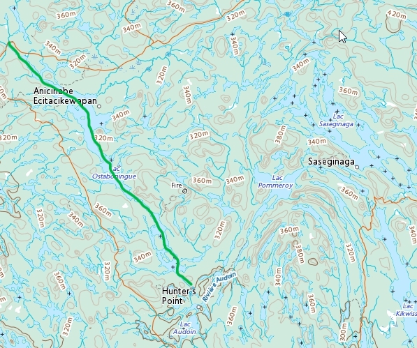
Portages: 250 meters at Ostaboningue/HP, take out
Trip Highlights: Beaches and great fishing
Put-in/Take-out Points:
- Zec Kipawa Welcome Center from Bearn access road.
- 151, W-78.887 camp site/boat launch
- Birch Lake rd. at Hunters Point (Ostaboningue/HP portage)
Day 1
Distance: 0- 10km
If you launch earlier in the day, I’d suggest putting in your boat at the very north end at the Zec Kipawa Welcome Center. If you arrive to the lake in the evening, you could camp for the night at the boat launch, this will cut your distance in half.

Day 2
Distance: 15km
This will bring you to the southern end of the lake for a couple options in campsites.
Day 3
Distance: 6km
Portages: 250 meters at N47.010941, W-78.806542
If there is spare time at the end of this day, you can use it to explore Hunters Point. The southern part of this portage takes you through a medicinal plant identification area. Down the river opens up to Hunters Point and here, you can explore an old church and other abandoned structures.